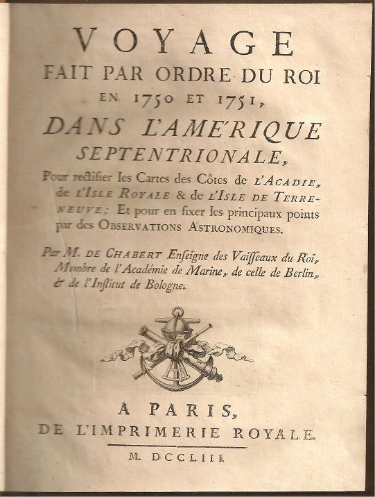
Voyage fait par Ordre du Roi en 1750 et 1751 dans l Amérique Septentrionale, pour rectifier les cartes des côtes de l'Acadie, de l'Isle Royale & de l'isle de Terre-neuve et pour en fixer les principaux points par des observations astronomiques
- Paris: Del'Imprimerie Royale, 1753
viii+[folding map]+288+[1 folding table]+[1 folding chart]+[x] pages with 6 folding engraved maps and index. Quarto (10 1/4" x 8") bound in contemporary quarter leather with green leather label to spine in gilt over calf-backed boards. (Sabin 11723; Howegego C87) First edition.
Joseph-Bernard de Chabert de Cogolin followed family tradition when he entered the navy as a midshipman in July 1741. After several voyages in the Mediterranean, where he displayed an interest in science and a talent for drawing charts that brought him to the attention of the minister of Marine, he was appointed sub-section leader of midshipmen and posted to Brest.
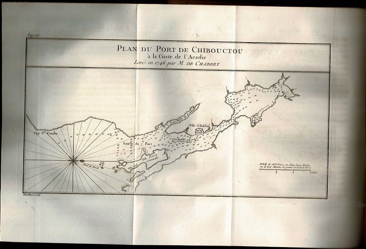
In 1746 he made two voyages to reconnoiter the coasts of Acadia and correct the defectiveness of French charts. While in the frigate Castor he drew a chart of the roads and harbor of the Baie de Chibouctou (Halifax harbor), and later the same year he was sent in the Sirène to reconnoiter the harbor at Annapolis Royal and spy out the British ships anchored there. The next spring he joined Jacques-Pierre de Taffanel de La Jonquière's squadron in the Gloire and was taken prisoner by the British during the battle off Cape Ortegal, Spain.
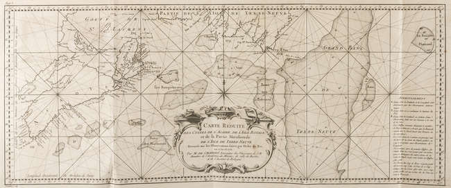
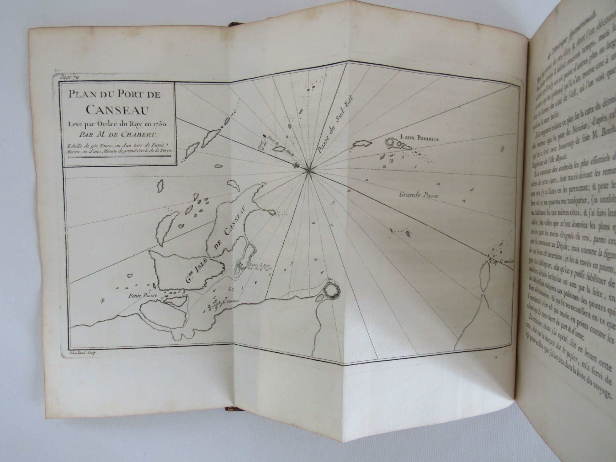
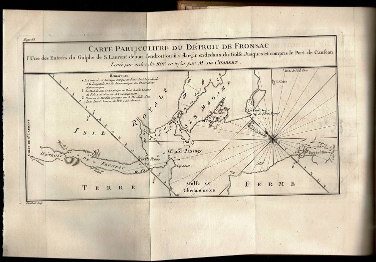
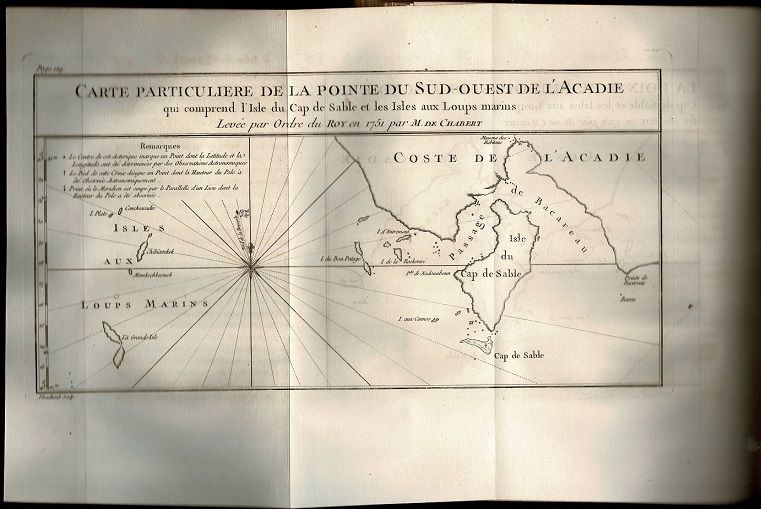
After repatriation Chabert was promoted ensign in April 1748 and retained in Paris by the minister, who wanted him to learn astronomy in order to instruct naval officers. Two years later he was chosen to go to Île Royale (Cape Breton Island) and continue his survey of the shores of Acadia. His expedition was organized by Roland-Michel Barrin* de La Galissonière, then head of the Dépôt des Cartes et Plans de la Marine in Paris. Chabert reached Louisbourg in August 1750 and immediately began to make a long series of observations about the waters of Île Royale. Although the weather was continually bad, he entered what is now the Strait of Canso, obtained a longitude from the shore, and twice observed the astronomical latitude. He also recorded tides and compass variations and charted the strait. At Canso itself he carried out similar observations and drew a second chart before returning to Louisbourg. He then surveyed the coast of Île Royale from Guyon Island, southwest of Cape Gabarus, northward beyond Scatarie Island. During the winter he had a but constructed on the ramparts at Louisbourg and despite the rigours of the climate successfully established the longitude of the town before spring. In June 1751 he departed for Cape Sable at the southern extremity of Nova Scotia to determine its latitude and longitude and then coasted along the shore. At the conclusion of his survey he discovered the length of Nova Scotia to be about 15 to 20 leagues shorter than was shown on contemporary charts. The following month he successfully located Sable Island, and in August he charted the southern coast of Newfoundland from Cape Ray to Cape Race. Returning to France in November, Chabert was attached to the Dépôt de la Marine under La Galissonière's direction and prepared his surveys for publication.
The result appeared in 1753 as Voyage fait par ordre du roi en 1750 et 1751, dans l'Amérique septentrionale. The work is in two parts: the first is an abridgement of his journal accompanied by charts; the second is devoted to his astronomical observations. It contained the most accurate hydrographic survey of the east coast that had yet been made, and the ministry of Marine subsidized publication by taking 200 copies for its own use. In 1754 Chabert was made a knight of the order of Saint-Louis as a reward for his services and two years later he was promoted lieutenant.
Condition: S2 slightly stained at lower margin, slightly foxed and toned, 3 small wormholes at tale of spine, slight separation of front head hinge, corners bumped else a very nice copy.
Details
Title
Voyage fait par Ordre du Roi en 1750 et 1751 dans l Amérique Septentrionale, pour rectifier les cartes des côtes de l'Acadie, de l'Isle Royale & de l'isle de Terre-neuve et pour en fixer les principaux points par des observations astronomiques
Author
Joseph-Bernard de Chabert de Cogolin (1721-1805)
Condition
Very Good
Publisher
Del'Imprimerie Royale: Paris
Date
1753
Edition
First
Size
Quarto
Pages
viii+[folding map]+288+[1 folding table]+[1 folding chart]+[x] pages with 6 folding engraved maps and index