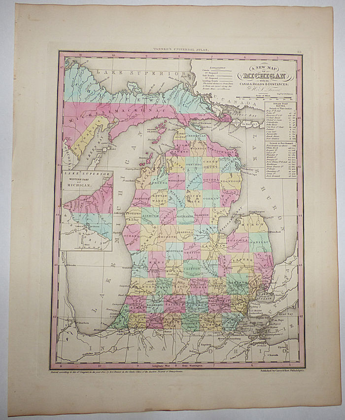
A New Map of Michigan with its Canals, Roads & Distances (Map No. 25 from A New Universal Atlas. . . .)
- Unbound
- Philadelphia: Carey & Hart, 1841
Philadelphia: Carey & Hart, 1841. Unbound. Very good. Approximately 14" x 17.5" including the wide margins. Includes an inset map showing the western part of the Upper Peninsula and a distance table for Detroit Steam Boat Routes. Strong, clear image with attractive hand coloring. Very light soiling.
This very attractive early map of Michigan shows little development north of the lower two tiers of counties with only a few identified cities or towns: Benton, Coltrellville, Corunna, Flint, Grand Haven, Grand Rapids, Hastings, Howell, Mason Centre (no Lansing), McDougalville, Mt. Clemons, Niles, Palmer, Pontiac, Portland, Remco, Sagnaw, Saugatuck, Tomia Center, Utica, and Vemontville.
Fairly scarce. At the time of listing, OCLC shows only three institutions with examples of this printing and three with examples of other printings, and no examples of any printings for sale in the trade. There are no auction results of this printing and three of other printings in the Rare Book Hub database.
Details
Title
A New Map of Michigan with its Canals, Roads & Distances (Map No. 25 from A New Universal Atlas. . . .)
Author
H. S. [Henry Shenk] Tanner
Binding
Unbound
Condition
Very Good
Publisher
Carey & Hart: Philadelphia
Date
1841