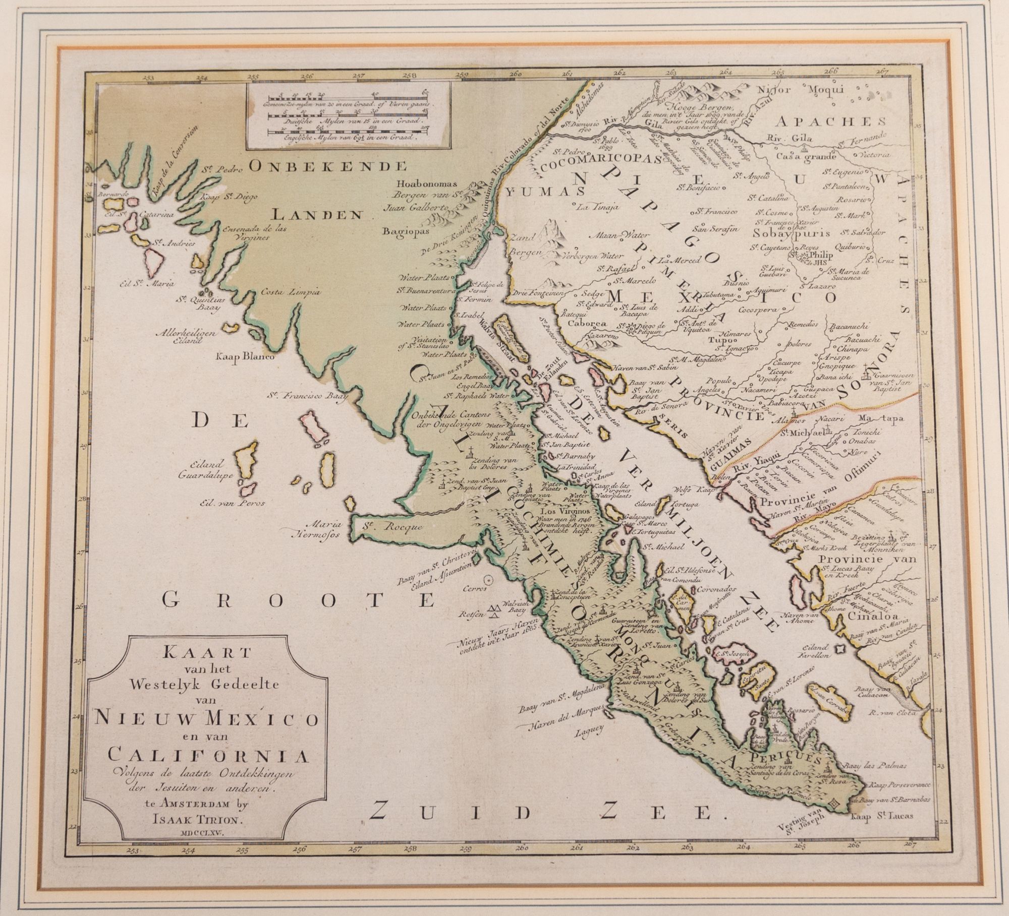
Kaart van het Westelyk Gedeelte van Nieuw Mexico en van California Volgens de Laatste Ontdekkingen der Jesuiten en Anderen
- Amsterdam , 1765
Amsterdam, 1765. Engraved hand-colored map, matted and framed. A beautiful hand-colored map of the American southwest focusing on the Southern California, Baja California, the Gulf of California and Arizona (notwithstanding the title, there is no portion of New Mexico depicted). Tirion names San Diego, the Santa Catalina Islands, Ensenada and Cabo San Lucas on the coast, plus Casa Grande on the River Gila, which, though marked as a mission, was a large site of a Native American ruin. He includes images of missions and forts in Baja at San Jose del Cabo and Loretto.
This is apparently the earliest printing of the map, published in Tirion’s Nieuwe en Beknopte Hand-Atlas (1765). It was re-issued a number of times over the next decade.
Tirion (1705-1765) was a Dutch publisher in Amsterdam. He produced several atlases and Dutch town plans, as well as a number of pamphlets which are all quite scarce.
Details
Title
Kaart van het Westelyk Gedeelte van Nieuw Mexico en van California Volgens de Laatste Ontdekkingen der Jesuiten en Anderen
Author
TIRION, Isaac
Condition
Unknown
Publisher
Amsterdam
Date
1765