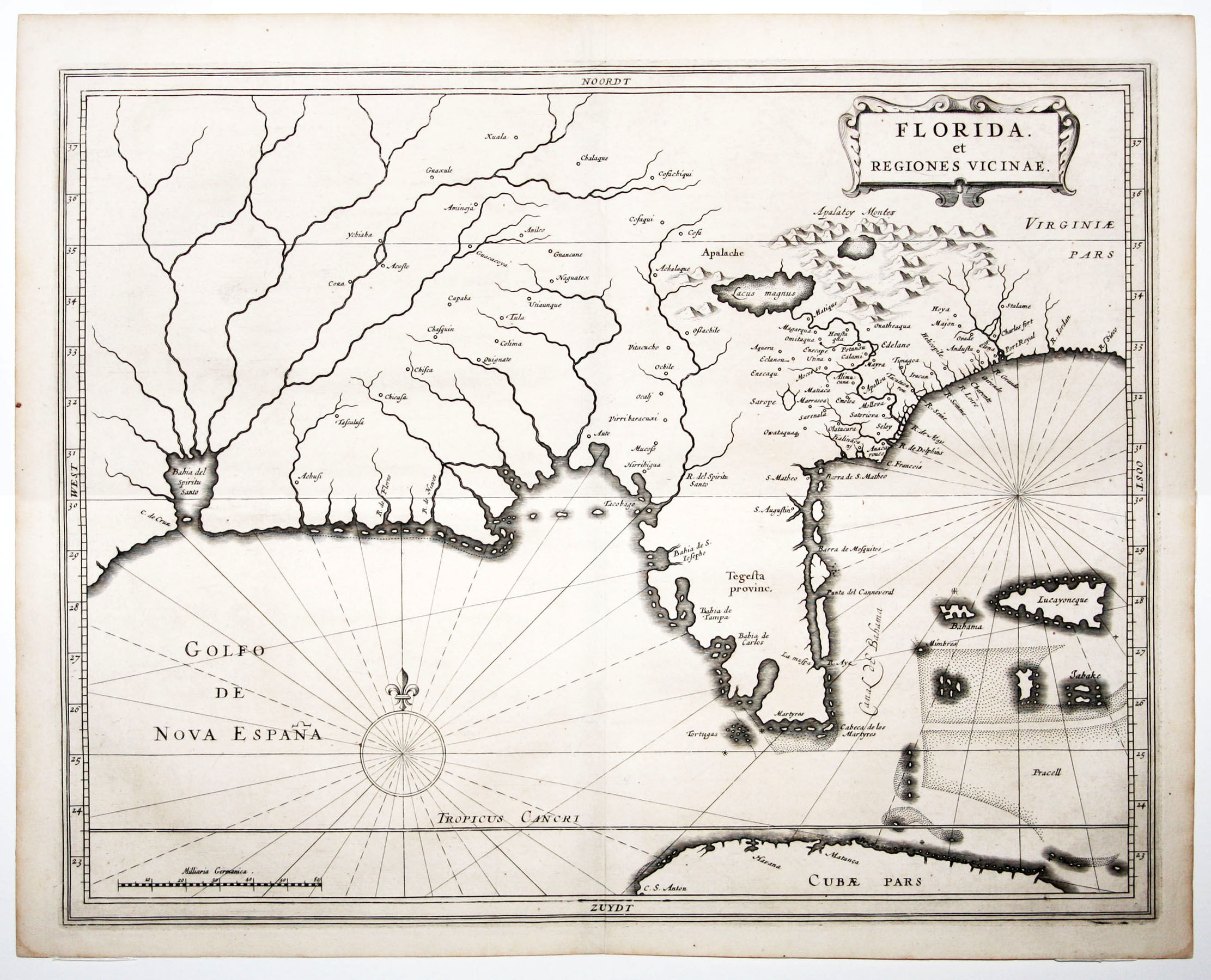
Florida et Regiones Vicinae
- No Binding
- Leiden , 1630
Leiden, 1630. No Binding. Fine. 11 x 14 inches. Fine condition. A key early map of Florida that differs significantly from previous works. Although Cumming says the De Laet combines information found on the Ortelius/Chiaves and the 1606 Mercator maps, it in fact contains substantial new information not found on these maps. The place names St. Augustine and Tampa Bay are seen here but are not on the Ortelius and the Wytfliet (1597) maps. The general shape of the Floridian peninsula is altered and called 'Tegesta Provinc,' one of the earliest appearances of a name that would be commonly used through the early 18th Century. Unlike the earlier maps, a series of barrier islands appears along the eastern shore of Florida on the de Laët, and a large fictional bay is also added in the southwestern corner of the peninsula. Again, unlike the Ortelius and Wytfliet, islands along the Gulf Coast between Florida and the Mississippi River are shown on the de Laët. In addition, the Suwannee River in the northwestern part of the peninsula is accurately placed on the de Laët but is named the "R. del Spiritu Santu." Hessel Gerritsz (b. 1580/81), the actual maker of the map, was one of the most important Dutch cartographers of the seventeenth century. At the age of 37, he was appointed the chief cartographer of the Dutch East India Company over the senior and more widely known , Willem Blaeu.. He subsequently drew maps for the West India Company as well, of which Johannes de Laët was one of the Directors. De Laët published this map as part of his book Nieuwe Wereldt ofte Beschrijvinghe van West-Indien. Cumming #34; Imago Mundi, VI, pp. 61-62.
Details
Title
Florida et Regiones Vicinae
Author
LAET, DE J./ GERRITSZ, H
Binding
No Binding
Condition
Fine
Publisher
Leiden
Date
1630